-
Adventurous, Expedition, Challenging
-
2 - 16
Overview
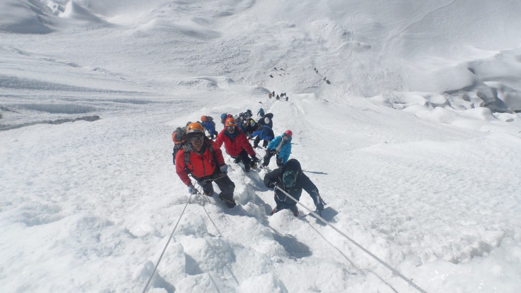
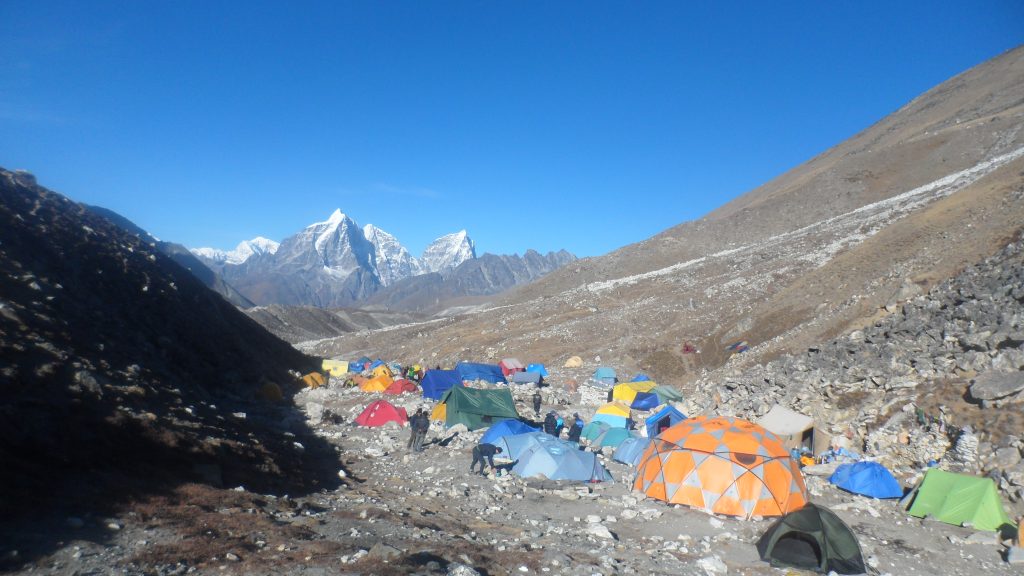
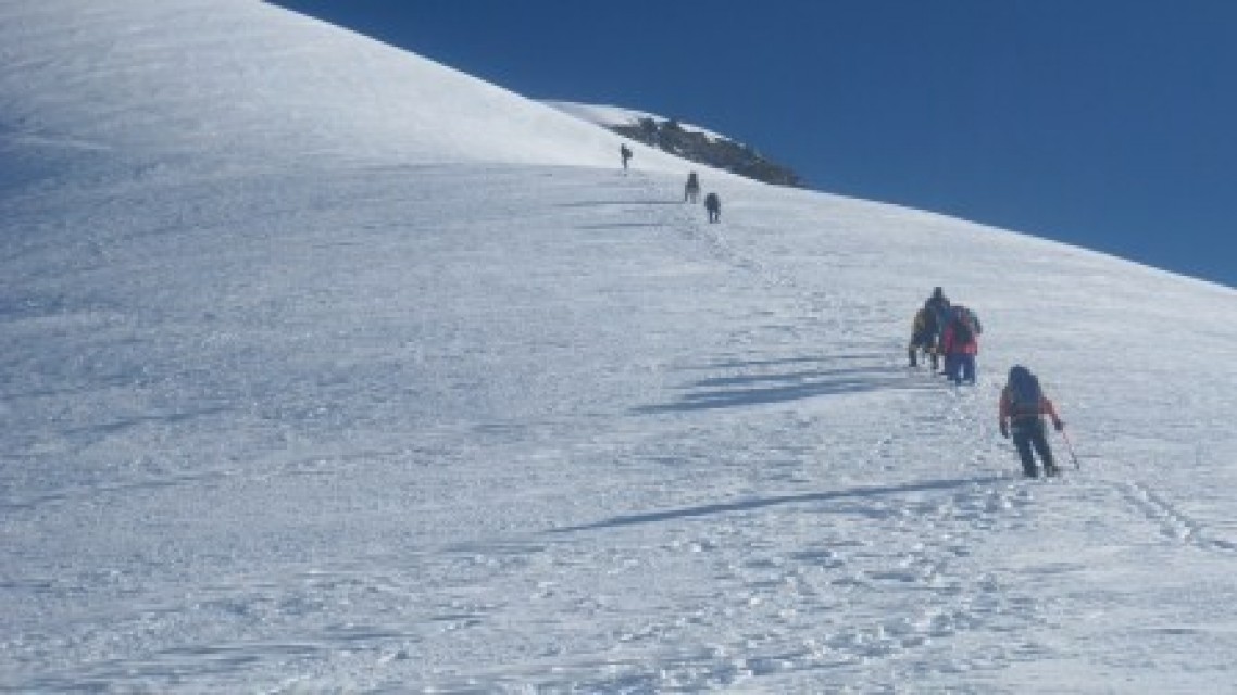
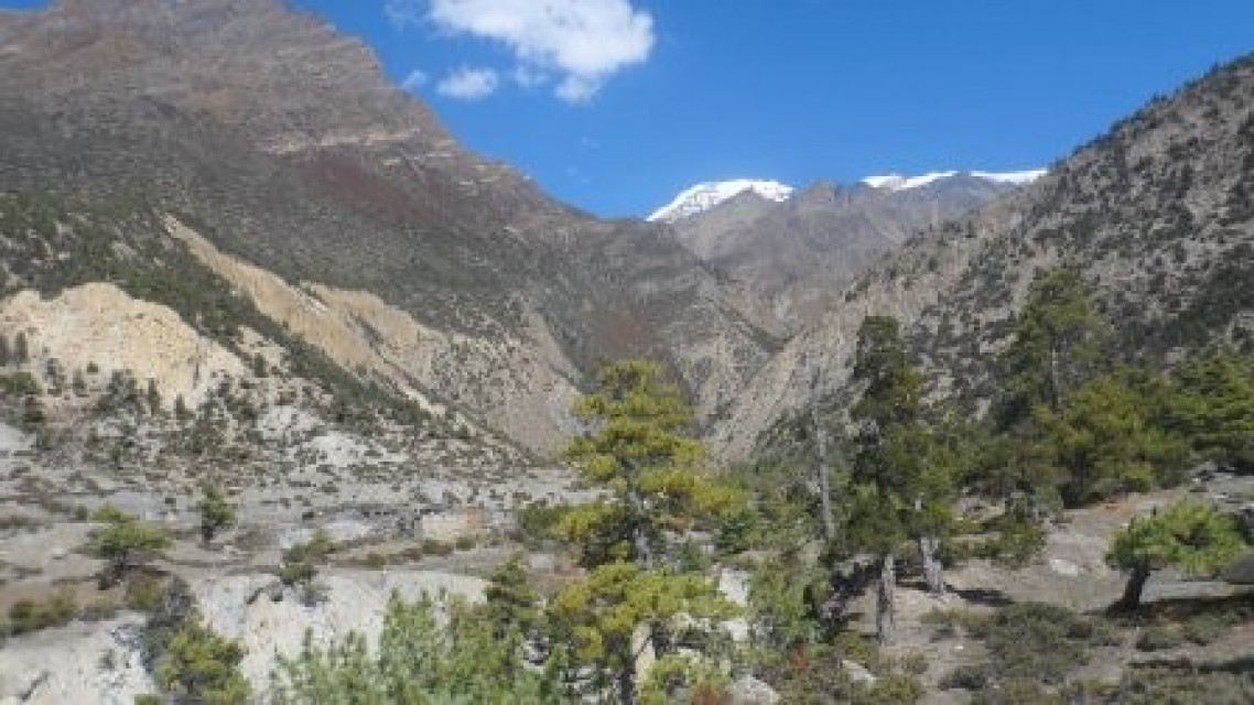
Chulu Far East and Thorong La Pass go through the location north of the Annapurna massif. This expedition in the Chulu range combines one of the finest trekking circuits in the world with a technically easy and relatively quiet trekking peak.We trek north along the Marsayangdi River, climb through the green mid-hills and the colorful mosaic of cultures into the alpine forest, and then up into the alpine meadows. The temperate climate soon gives way to the arid desert conditions of the Manang district. We leave the main trekking trail at Pisang and head off along the Chetsi Khola towards Chulu Far East and our base camp. We are now entering the alpine wilderness of snow, rock and very cold temperatures. For the next four days, we remain among these magnificent peaks. The exact timing of our final push for the Chulu Far East summit will depend on the conditions and the acclimatization of the group. We’re going to set up a base camp at 4,600 m and then move.
Trip Highlights
- Expedition in the Chulu range. Experience the alpine wilderness of snow, rock and very cold temperatures. World’s finest trek circuits. Technically easy and relatively quiet peak.
Itinerary
Arrive Kathmandu, transfer to hotel.
We leave Kathmandu early in the morning and drive towards Pokhara. After leaving the Kathmandu valley the road snakes its way westwards along the Trisuli Valley. We get superb views of the mountains, particularly the Ganesh Himal and Manaslu as we follow the river to Mugling. We then turn off the main road and continue to Besisahar where we begin our trek (sometimes we may be able to drive further than Besisahar). From Besisahar we walk down to the river and cross to the east side to avoid the new road which is currently under construction. Our trail undulates above the river, continuing northwards up the Marsyangdi Valley with Himalchuli and Peak 29 dominating the horizon. The trail takes us on quiet trails through rice paddies and villages for two or three hours until we meet the main trail at Bhulebule.
The trail continues up the east bank of the river passing a beautiful waterfall to Ngaddi. Here we cross a suspension bridge and then begin a steady climb through scrub forest finally arriving at Lampatta, a Manangi village with Tibetan style prayer flags. A final short sharp ascent brings us to the village of Bahundanda at 1311m. From the ridge we descend to the river at Syange (1136m). The trail then follows the track to Jagat.
An undulating trail leads to Chyamje, after which we cross a suspension bridge and climb through oak forest. The river disappears from view as we climb over a ridge. The trail then emerges into a level valley where Tal, the next village is situated at the foot of a grand waterfall (1,700m). Crossing the river again the path ascends the narrowing valley, descending to cross the river to the village of Dharapani at 1,943m.
Our walk continues as we climb over a spur to Bagarchap, at 2164m. The name of this village means butcher’s place and, although Buddhist, the people of this region do hunt animals. Continuing we follow the trail through forest to Dhanagyu and climb up to Temang, where we have lunch with magnificent views of Manaslu and Peak 29. The trail then descends though fir and pine forests to Koto and Chame (2,713m), administrative centre of the Manang district.
We now experience a dramatic change of scenery. Leaving the forests and vegetation of the alpine regions behind we enter the upper district of Manang, known as Nyeshang. At first our trail follows the river closely through a deep canyon, passing a number of waterfalls on the other side of the river before coming to Brathang at 2919m. The trail then follows the steep narrow valley through deep forest from which there are fine views of Annapurna II. We cross the river where the impressive curved rock face of Paungda Danda rises nearly 1,500m from the riverbank, and climb away from the noise of the water to the village of Pisang at 3,185m. Today is only a short day and there will be time in the afternoon for an acclimatisation hike to Upper Pisang village for great views of the Annapurnas ahead.
We have an acclimatization walk on the high trail through Gyaru to Ngawal (3,657m). This is a trail with amazing views across the valley towards the Annapurnas. Both Gyaru and Ngawal are traditional Tibetan style villages where the pace of life has not changed for centuries. After lunch in Ngawal we leave the main trail and head off above Julu village to camp in a forest clearing at 3,962m.
A long hard day today as we ascend the valley to base camp. The trail follows the river easily at first passing herder’s huts to the base of a steep hill. The trail then climbs very steeply to the crags high above us. The trail zig zags seemingly forever with great views ahead and to our left of a couple of 2 magnificent (often frozen) waterfalls. Finally we round a corner and descend to our base camp at 4,860m.
We spend the day here for acclimatization. In the morning we go for a walk onto the hills around us. We also have time gear checks and some practice for the climb. We will practice ice axe and crampon techniques, walking roped up and the use of the jumar and abseil device.
A short day to high camp (5,465m), where there will be time for more acclimatisation and more practice for the climb. From high camp expect views of the Annapurnas with an incredible sunset and sunrise. We will have an early dinner this evening in preparation for tomorrows early start.
Summit day will start very early (usually around 2/3am in the dark). From high camp we have a steep climb up to a col at approx 5,600m. We can see the wonderful summit ridge ahead. From the col the sherpas will fix ropes most of the way to the summit as there can be ice on the route. We will use a jumar up the fixed ropes. It will take about 7 hours from camp to the summit. The hard work is rewarded with incredible views from the top n front of us is Gangapurna, the Annapurnas and Herzog Great Barrier to our left is Manaslu and behind us lies Tibet. We descend carefully past the high camp, where we will have a good rest and then descend all the way to base camp.
Today we retrace our steps down the hillside past the Yak Kharka camp and further down to Julu village. Please not that in case of bad weather on summit day this day will be used as a buffer day.
We say goodbye to some of our porters and cook as we trek to join the main trail again. An easier half day today as we descend to the Manang Valley and follow the main trail to Manang. We can visit the small village of Braga on the way with its ancient monastery towering high above the village. Braga is also home to a small tree nursery which is a project we have been supporting for the last 10 years. A short walk from Braga brings us to Manang where we stay in a tea house.
Leaving Manang we head to the base of the Thorong La. We climb out of the Marsyangdi valley and turn northwest up the valley of the Jarsang Khola. We are above the forests now and pass through the dry, alpine country, with scrub juniper and occasional clumps of birch. We stay tonight at Yak Kharka.
The trail climbs further up the valley and at one point descends to cross the Jarsang Khola. Look out for herds of Blue Sheep. A traverse across a scree slope brings us to the lone teahouses at Thorong Phedi which is surrounded by high cliffs at the foot of the Thorong La (4,400m.). We should be there by lunchtime and those feeling energetic can take a walk up to the Thorong High Camp, about an hour from Thorong Phedi.
A long day as we leave Phedi very early for the climb to the pass. The first part of the ascent is very steep, but it becomes easier as we approach the top, although the altitude still makes the going tough. Eventually, after numerous false summits, we reach the pass itself at 5,416m. Ahead there is a magnificent panorama of snow-capped peaks extending northwards into Tibet, and looking back we can see several of the main peaks of Annapurna. Directly in front of us is the great chasm of the Kali Gandaki, 2,500m. below. The long descent starts gently but becomes steeper before easing off to a gentle descent to Muktinath (3,802m).
From Muktinath, we pass through a landscape of bare, eroded hills with a backdrop of snow-capped high peaks. After visiting the temples above Muktinath, we follow the main trail down the valley through a magnificent landscape of wind-eroded cliffs in an array of beautiful colors. A final descent brings us to the Kali Gandaki Valley at Eklabatti, from where an easy trail brings us to the end of our trek at Jomsom.
The flights from Jomsom to Pokhara are usually in the early morning due to the high winds which blow up the Kali Gandaki Valley later in the day. The short but very spectacular flight takes us all the way down the Kali Gandaki Valley with great views of Niligiri and Dhaulagiri. We fly to Pokhara, where we transfer on to another flight back to Kathmandu.
Free day in Kathmandu, you can go sightseeing at Durbar Square in the heart of the old city.
Depart Kathmandu
Cost Includes
- Trekkers information management system (TIMS) registration card
- All necessary airport Pick up and drop off.
- All necessary permits
- First aid medical Kit
- International and internal airport arrival and departure transfers
- Airport pick up and drop transfer to hotel.
- Necessary permits and fees
- RT Bags 1 per client
- All accommodation at tea house/lodge on B&B twin (double room) sharing basis with Breakfast during the trek.
- Oxygen backup for Emergency
Cost Excludes
- International airfare to and from Kathmandu & Nepal visa fee
- bar bills
- Any extra cost arising out of natural calamities or cancellation of the program
- Alcoholic Beverages.
- International air ticket and airport tax.
- The services not mentioned in “cost Includes
- All type of insurance for participants
- Beverages and snacks
- Personal expenses such as telephone calls
- Personal medical insurance and Medicine
- Personal hiking gear
Write a Review